
History of the old town
Timeline

Historical Overview
The history of Borgarnes dates back to the time of Icelandic settlement.
In Egil’s saga, it is said that Skallagrímur and his father Kveldúlfur moved from Norway to Iceland in the end of the 9th century. But Kveldúlfur did not survive the journey. To fulfil his last wish, his coffin was thrown into the sea, in Borgarfjörður. And his son settled where it came to land, in the peninsula of Digranes. Today the peninsula is called Borgarnes.
Skallagrímur built a farm in Borg á Mýrum out of the present town of Borgarnes. He also built a farm not far from it for one of his men, Grani, and his son, Thord. The place is known as Granastaðir. However, Skallagrímur used the land in Borgarnes itself for livestock grazing and for hunting birds and seals. The saga also tells an important story occurring there, the one about Þorgerður Brák, Skallagrímur’s maid. It is said that she died in the sea after being hit by a stone thrown by Skallagrímur. Today this place is known as Brákarsund, the Strait of Brák.
The place where Kveldúlfur was buried is not known with certainty. But a mound of uncertain origin recalls the character in Kveldúlfsvöllur (field of Kveldúlfur). It is near the burial mound of Skallagrímur -and his grandson Böðvar Egilsson, located in the main park of Borgarnes called Skallagrímsgarður
(garden of Skallagrímur).
Indeed, various place-names in Borgarnes keep the memory of these events: Kveldhúlfshöfði (cape of Kveldúlfur) and Kveldúlfsvík (bay of Kveldúlfur) where Kveldúlfur’s coffin may have been found, east of the present town; Brákarey (Island of Brák), Litla Brákarey, Brákarpollur (pool of Brák) and Brákarsund where the maid was killed.
This is precisely where the town of Borgarnes began to emerge in the second half of the 19th century: along the coast near Brákarpollur and Brákarsund.
In general it all started with the urbanisation of Iceland in the end of the 18th century-beginning of the 19th century. Reykjavik emerged and so did Borgarnes a few decades later. At that time, poeple from Borgarfjörður had to travel long (to Reykjavík, Stykkishólmur or Búðir) for supplies and to trade. They petitioned the parlement for the creation of a market town in Borgarnes by Brákarpollur. The place was well located geographically and offered opportunities to accomodate boats and constructions. In 1867, permission was granted.
There was only one house in Borgarnes by then. It had been built in 1857 by a Scot, James Ritchie, for salmon canning. In 1877, two English built another house for salmon fishing in the same place that was named Englendingavík, the English Bay. But these houses no longer exist today.
The first resident, registered as such in 1878, was the postman Teitur Ólafsson. He lived in a house
(Kaupangur) built in 1877 by the Norwegian carpenter Ole Johan Haldorsen on a cliff named Búðarklettur or Suðurnesklettur near a beach used for landings. This sand beach would later be called Sandurinn. Not far away, Jón Jónsson, nicknamed Akra-Jón, also started a store in a building erected by the same in 1878. Finally, a warehouse was built right beside it by the Norwegian merchant, Johann Lange, between 1887 and 1889. At the same time commercial activities also developed in Englendingavík where various houses were built for that use from 1885. All these houses still stand. They are the oldest buildings in Borgarnes.
At first, the small setllement grew very slowly, from 11 inhabitants in 1880 to 21 inhabitants in 1890 and 50 in 1900. It really began to develop at the beginning of the 20th century where boats could anchor, around Sandurinn. It was the town‘s center of gravity. Borgarnes enjoyed by then a period of political, demographic and economic development. The town became an independant municipality with its charachteristic institutions in 1910. And the population increased from 50 inhabitants in 1900 to 432 in 1930. While many worked in the commercial sector, the majority of the population worked as day laborer in various sectors including small-scale industries. For the latter in particular, but likely also for all the people in Borgarnes, domestic food production was important at that time. In 1904, the commercial company Kaupfélag Borgfirðinga was established. A store named Salka was built on the cliff named Miðnesklettur, located between Sandurinn and Englendingavik, to host their activities in 1912. The success of this company, which diversified its activities, impacted a lot the development of the town. They moved to Englendingavík shortly after, paving the way to the establishment of services and stores in that part of the town, on streets now known as Skúlagata and Egilsgata. At these places, you could find the Hotel Borgarnes in 1905, the bank Sparisjóður in 1913, etc... At mid-century, Egilsgata even became the main shopping street of the town, hosting the new department store of the company.
The political, demographic and economic development also led the authorities to initiate a public work policy, starting with the construction of the port. In 1929, a bridge (Brákarsundbrú) and a pier were built on the island of Brákarey (more precisely Stóra-Brákarey). It was the first step in developing the new harbour area. This allowed fishing to develop and greatly improved transport of goods and people. Borgarnes then became an important stopping point between the south and north of Iceland, as evidenced the slogan: “All roads run through Borgarnes”. For most of its history indeed, Borgarnes was mainly connected by sea to the rest of the country. In 1938, the first expansion plan of Borgarnes was designed by the arkitekt Sigurður Guðmundsson. Logically, the road Borgarbraut-Brákarbraut
that ran from the harbour of Brákarey to the edge of the town was the main road in the plan. Among projects intended to be carried out, it envisaged the development of the garden planted by the Women’s Association and the Young People’s Association of Borgarnes (Kvenfélag and Ungmennafélag) near the tomb of Skallagrímur, the development of new residential districts beyond the swamps of Skallagrímsdallur (valley of Skallagrímur) and land filling operations in Sandurinn where the milk factory (Mjólkursamlag Borgfirðinga) had already started to be built.
The population continued to grow at a slower pace during the second part of the 20th century, from 751 in 1950 to 1726 in 1990, and 1891 in 2006. In 1994, the town merged with three other districts and ceased to be an independent municipality after 80 years as such. The new municipality was named Borgarbyggð. Creation of two universities in the region (Agricultural University at Hvanneyri/Agricultural University of Iceland and Bifröst University) certainly contributed to the demographic development. Consequently, urbanisation continued to expand inland.
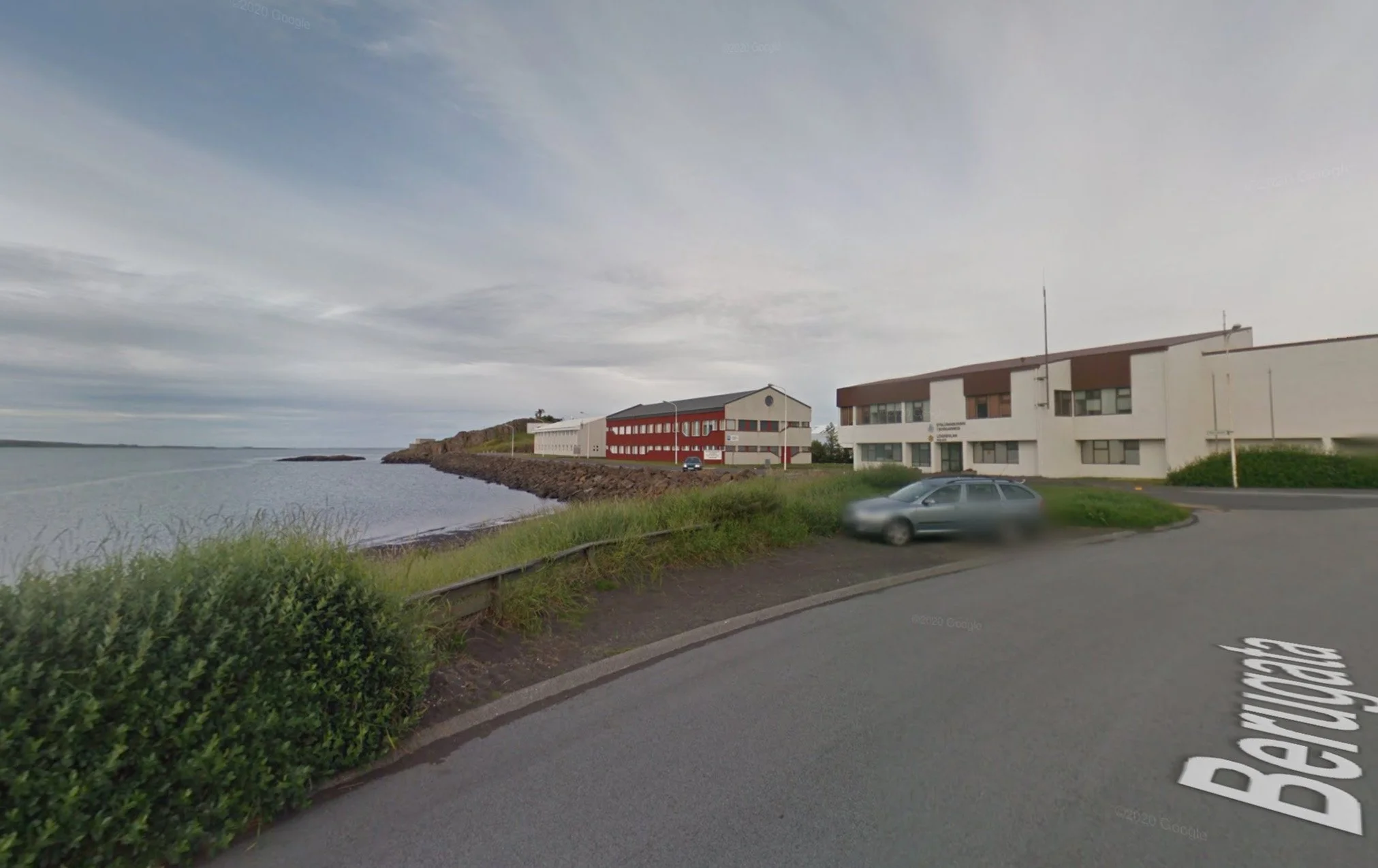
But changes in transportation modes and infrastructure radically transformed Borgarnes. The increasing use of cars and the national road development in Borgargjörður caused the decrease of maritime transport in Borgarnes as early as the 1940s and 1950s. This progressively led to the Brákarey port decline. The construction of a bridge (Borgarfjarðarbrú) in the immediate vicinity of the town, on the national road, in the 1980s led to the grouping of many services, commercial and industrial activities around the national road. On the outskirt of the town, a new town center called Brúartorg (square of the Bridge) developed where the bridge landed on the shore, drawing away the activities and shops that were in the old center, around Brákarpollur.
Comparison - From the past to today

A- This is one of the two trading places that started in Borgarnes. The kliff’s name is Suðurnesklettur and the beach’s name is Sandurinn. It was a good landing for boats. Now the beach has been filled up for new buildings and the old trade houses host a settlement museum, Landnámssetrið.


B- This is the other trading place where commerce started and conditions were good to land boats. It is called Englendingavík because the first business there was started by two Englishmen. This place has kept its charm, old houses and its sand beach. The timber docks have disappeared.


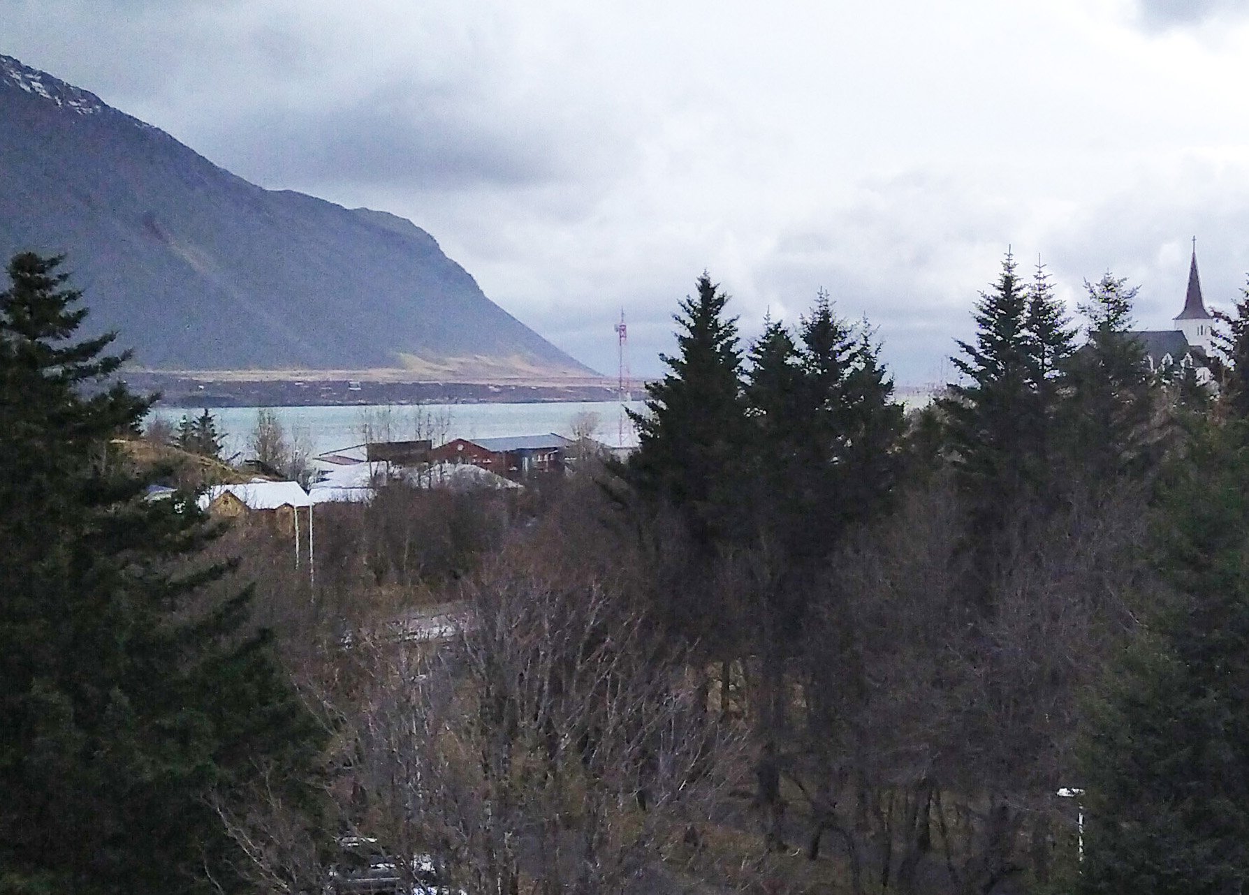
C- Hrognkelsavík is the name of a cove on the east end of the peninsula. The sand beach, Sandurinn, that went over the peninsula was first filled up in the 20s and then in the 70s and 80s came a land fill out in the sea.

D- The photo from 1930 shows salt fish being dried on the south cliffs, with Brákarey in the background. In 1929 a bridge was built to the isle where the harbour was made.

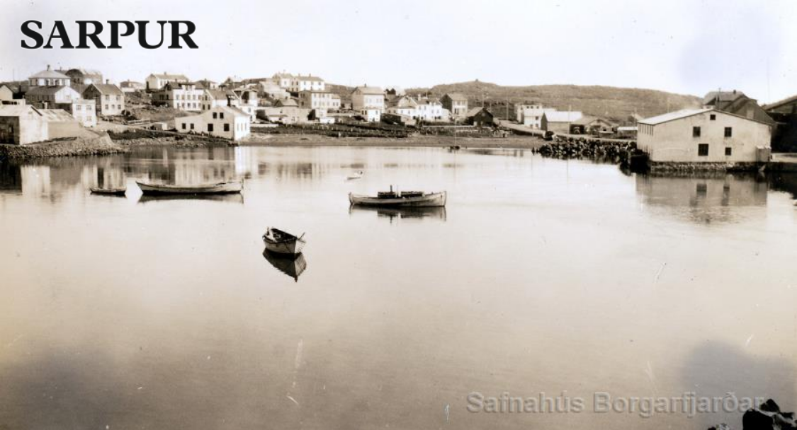
E- These photos show the old centre from Brákarey. The sand beach, Sandurinn, used for landings boats is still visible in 1950 before it disappeared under a big land fill with new houses.


F- The slaughterhouse of Borgarnes was built in 1908 and demolished in 2004. An important landmark and historic building disappeared. It was in the axis at the end of Brákarbraut. The principal stone dock that was beside it still partly remains.


G- The harbour of Borgarnes used to be very lively when the boats came in. These days where called bátadagar (boatsdays). The boats had to come in and go out on a tide. Now there is little life at the harbour.


H- Skallagrímsdalur is a small swampy valley that made a separation between the neighbourhoods of the town. The two Viking graves from the 9th century are where now the land has been dried up and a public park situated.

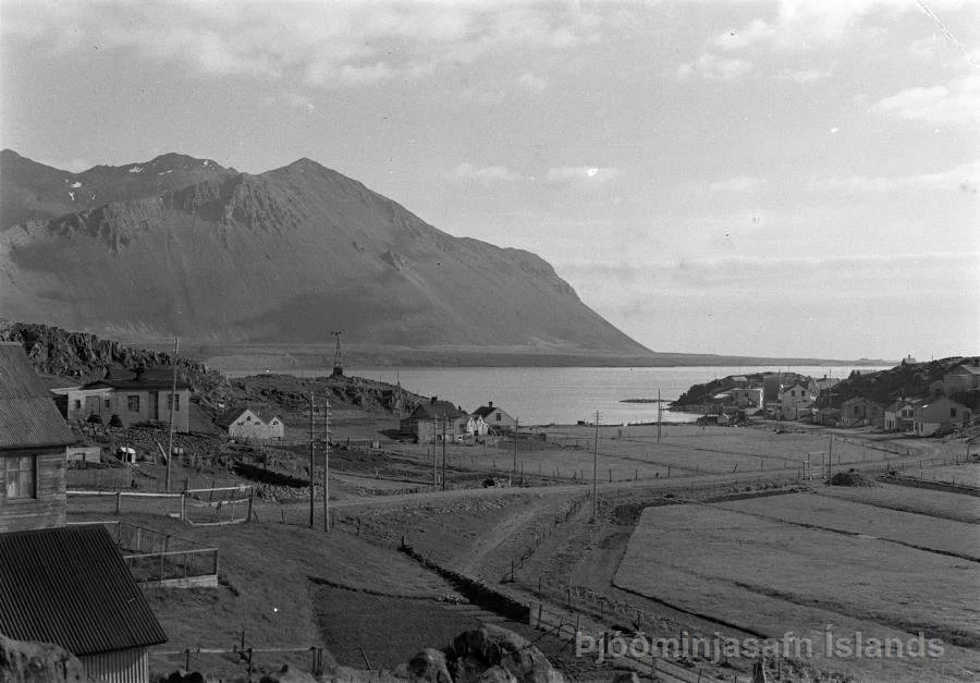
I- The field of the valley of Skallagrímur went all the way down to the sea beach at Hrognkelsavík, that now has a land fill that goes far in the sea. Here are now trees and houses.

J- The park Skallagrímsgarður developed near the tomb of Skallagrímur along the main road to Borgarnes, i.e. Borgarbraut. At this place, the road divided in two paths. One of them developed (Borgarbraut-Brákarbraut) while the other one is now a promenade with a stair.
